

What the weather has in store for us this winter.
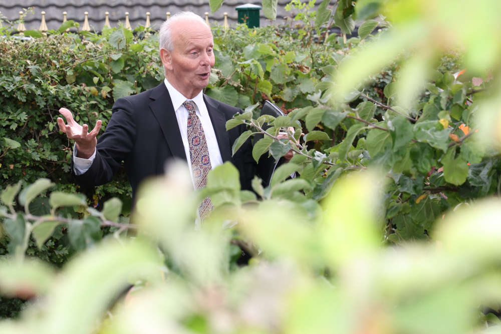
As the clocks turn back this weekend, the darker nights draw in and temperatures start to drop, our resident weatherman David Biewlawski takes a look ahead at the winter season to come.
The big news is that after basking in balmy temperatures and heat waves during the summer, we should brace ourselves for a cold winter ahead - and yes - even the possibility of a white Christmas.
David, who has studied environmental sciences and is a RHS NW Britain in Bloom judge, has been fascinated by the weather since childhood.
His predictions earlier this year that we would enjoy a warm summer were ‘sun spot’ on, but now as we get ready for those darker nights, David is advising residents to prepare to wrap up warm, with even a white Christmas on the cards, although that doesn’t guarantee there will be lots of snow.
“We don’t need much snow to officially count as a white Christmas,” says David from Stalybridge.
“But this year it could happen and this coming winter is set to be a cold one.”
We reported how David, who has been studying the weather for many decades, had predicted the warm summer back in the spring, when he explained the main reasons behind it: “The main factors were the high sun spot numbers, plus reference to my own temperature profiles which I began in 1986, which indicated a warmer summer. Sea surface temperatures also played a part.
“It should be noted that current science states that forecasting beyond 30 days is not possible, but I use my own scientific methods and extensive experience to test my own theories.”
Drawing on that experience, David has outlined what weather you can expect in the coming months, at the end of which we’ll be able to put his theories to the test!
October
Unsettled showery weather continuing to end of the month. Temperatures below normal. Storm force winds (which we’ve already had) possible.
November
Starts cool with showers turning wintry on hills, these conditions lasting until the 20th, briefly drier with night frost. Wetter, windy conditions during the last week, with wintry showers on all high ground to end the month. A cold month.
December
Starting cold but quickly turning milder and wet and becoming very windy, lasting until the 20th. A change then to colder conditions with wintry showers, lasting up to the Christmas period, with night frost and temperatures below normal. The last week will be cold and wet with rain, sleet and hill snow. Windy at times.
January
Starts milder and wet with severe winds, storm force in places. Mid month around the 15th, colder conditions will arrive with sleet and snow in places, becoming drier and frosty lasting until the last week. Fog possible, wetter milder conditions arrive to end the month.
February
Starts mild and wet, quickly changing to colder drier conditions with a severe frost in places and fog, lasting until the 18th when it will become more unsettled and windy, with rain sleet and snow to end the month!
Summary
Autumn starts warm, then changes to colder conditions as we enter the winter period. A cold winter is favoured. Storm force winds, especially during the autumn.
The main factors driving this autumn/ winter projection are high sunspot numbers and a qbo in its easterly phase.
Also it’s possible that a sudden stratospheric warming event could occur. Reference to my own temperature profiles which began in September 1986. Sea ice in the north Atlantic.
Information provided by David Bielawski. D.M.S dipra. Dip arb. Ndt. Nch. Cert environmental science open university. Cert environmental science Manchester University.
 First choice secondary school offers reach ten-year high in Tameside
 Dance festival to celebrate Tameside’s rich culture and heritage comes to Hyde
 Free family fun at Spring Up in Mossley
 Robins issue urgent appeal

