

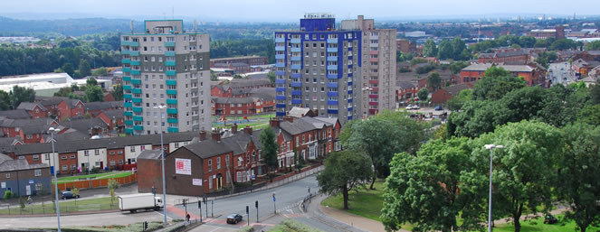
Thousands more Greater Manchester households including in Oldham and Tameside could be at risk from the impacts of flooding in the next 25 years unless action is taken, new research has shown.
Aviva’s Building Future Communities report brings together the latest data to outline the risks that homes could face from multiple climate threats by
2050 and beyond, including flooding, subsidence and extreme heat.
Surface water flooding is predicted to threaten tens of thousands more homes in Greater Manchester.
The report states that of the 75,869 households in the Manchester Central constituency, 15,989 are currently at risk from river or surface water flooding.
By 2050, the report suggests that figure will rise to 20,418, meaning 27 per cent of households would be a risk.
Similarly in the Salford constituency, where there are 70,774 homes, by 2050, 31,081 are predicted to be at risk of flooding, a whopping 44 per cent of households.
Surface water flooding– or flash floods – which are harder to predict and protect against, are also likely to increase.
Environment Agency data suggests the number of properties at risk in England could rise to 6.1 million between 2040 and 2060, including a 66 per cent rise in the number of properties at high risk.
According to Aviva’s analysis, urban and densely populated areas, including Manchester, London and areas of the North East, could be hotspots for surface water flooding in future due to the greater prevalence of hard surfaces, which can prevent rainwater from draining.
According to the report, some of the UK’s most well-known landmarks, including Cardiff Bay, York city centre and Liverpool waterfront, could be vulnerable to flooding because of rising sea levels, heavier rainfall and more frequent weather events.
Jason Storah, CEO UK & Ireland General Insurance, Aviva, said: “In the UK we have seen the impacts of our changing climate and this year is no exception.
“Record temperatures, wildfires and flash flooding have affected lives across the globe and it is clear that action is needed to adapt to the increasing
frequency of these events.
“Our Building Future Communities report lays bare the risks that homes and businesses could experience by 2050.
“The findings are stark. Millions more properties could be at risk from flooding, with rising temperatures, increased urbanisation and inadequate
drainage exacerbating the risks in future.”
Using Aviva’s data, the Local Democracy Reporting Service has broken down the figures in every parliamentary constituency in Greater Manchester to illustrate the rising proportion of properties at risk from flooding:
Bolton
Bolton North East
Number of households in constituency 53111
Number of properties with river or surface water flood risk in 2025 6739
Number of properties with river or surface water flood risk in 2050 8948
Proportion of properties with flood risk in 2025 (%) 12.7
Proportion of properties with flood risk in 2050 (%)16.8
Bolton South and Walkden
Number of households in constituency – 53213
Number of properties with river or surface water flood risk in 2025 – 6897
Number of properties with river or surface water flood risk in 2050 – 9131
Proportion of properties with flood risk in 2025 (%) – 13.0
Proportion of properties with flood risk in 2050 (%) – 17.2
Bolton West
Number of households in constituency – 46319
Number of properties with river or surface water flood risk in 2025 – 5786
Number of properties with river or surface water flood risk in 2050 – 7591
Proportion of properties with flood risk in 2025 (%) – 12.5
Proportion of properties with flood risk in 2050 (%) – 16.4
Bury
Bury North
Number of households in constituency – 48038
Number of properties with river or surface water flood risk in 2025 – 6822
Number of properties with river or surface water flood risk in 2050 – 8838
Proportion of properties with flood risk in 2025 (%) – 14.2
Proportion of properties with flood risk in 2050 (%) – 18.4
Bury South
Number of households in constituency – 47178
Number of properties with river or surface water flood risk in 2025 – 7314
Number of properties with river or surface water flood risk in 2050 – 8867
Proportion of properties with flood risk in 2025 (%) – 15.5
Proportion of properties with flood risk in 2050 (%) – 18.8
Manchester
Blackley and Middleton South
Number of households in constituency – 47989
Number of properties with river or surface water flood risk in 2025 – 6216
Number of properties with river or surface water flood risk in 2050 – 7976
Proportion of properties with flood risk in 2025 (%) – 13.0
Proportion of properties with flood risk in 2050 (%) – 16.6
Gorton and Denton
Number of households in constituency – 48421
Number of properties with river or surface water flood risk in 2025 – 7401
Number of properties with river or surface water flood risk in 2050 – 9600
Proportion of properties with flood risk in 2025 (%) – 15.3
Proportion of properties with flood risk in 2050 (%) – 19.8
Manchester Central
Number of households in constituency – 75869
Number of properties with river or surface water flood risk in 2025 – 15989
Number of properties with river or surface water flood risk in 2050 – 20418
Proportion of properties with flood risk in 2025 (%) – 21.1
Proportion of properties with flood risk in 2050 (%) – 26.9
Manchester Rusholme
Number of households in constituency – 45923
Number of properties with river or surface water flood risk in 2025 – 12029
Number of properties with river or surface water flood risk in 2050 – 17842
Proportion of properties with flood risk in 2025 (%) – 26.2
Proportion of properties with flood risk in 2050 (%) – 38.9
Manchester Withington
Number of households in constituency – 39728
Number of properties with river or surface water flood risk in 2025 – 10850
Number of properties with river or surface water flood risk in 2050 – 14037
Proportion of properties with flood risk in 2025 (%) – 27.3
Proportion of properties with flood risk in 2050 (%) – 35.3
Wythenshawe and Sale East
Number of households in constituency – 51063
Number of properties with river or surface water flood risk in 2025 – 10232
Number of properties with river or surface water flood risk in 2050 – 14704
Proportion of properties with flood risk in 2025 (%) – 20.0
Proportion of properties with flood risk in 2050 (%) – 28.8
Oldham
Oldham East and Saddleworth
Number of households in constituency – 46447
Number of properties with river or surface water flood risk in 2025 – 5566
Number of properties with river or surface water flood risk in 2050 – 7754
Proportion of properties with flood risk in 2025 (%) – 12.0
Proportion of properties with flood risk in 2050 (%) – 16.7
Oldham West, Chadderton and Royton
Number of households in constituency – 46245
Number of properties with river or surface water flood risk in 2025 – 5428
Number of properties with river or surface water flood risk in 2050 – 7398
Proportion of properties with flood risk in 2025 (%) – 11.7
Proportion of properties with flood risk in 2050 (%) – 16.0
Rochdale
Heywood and Middleton North
Number of households in constituency – 47297
Number of properties with river or surface water flood risk in 2025 – 4583
Number of properties with river or surface water flood risk in 2050 – 6183
Proportion of properties with flood risk in 2025 (%) – 9.7
Proportion of properties with flood risk in 2050 (%) – 13.1
Rochdale
Number of households in constituency – 45031
Number of properties with river or surface water flood risk in 2025 – 5970
Number of properties with river or surface water flood risk in 2050 – 7766
Proportion of properties with flood risk in 2025 (%) – 13.3
Proportion of properties with flood risk in 2050 (%) – 17.2
Salford
Salford
Number of households in constituency – 70774
Number of properties with river or surface water flood risk in 2025 – 25897
Number of properties with river or surface water flood risk in 2050 – 31081
Proportion of properties with flood risk in 2025 (%) – 36.6
Proportion of properties with flood risk in 2050 (%) – 43.9
Worsley and Eccles
Number of households in constituency – 51298
Number of properties with river or surface water flood risk in 2025 – 9802
Number of properties with river or surface water flood risk in 2050 – 14156
Proportion of properties with flood risk in 2025 (%) – 19.1
Proportion of properties with flood risk in 2050 (%) – 27.6
Stockport
Cheadle
Number of households in constituency – 43287
Number of properties with river or surface water flood risk in 2025 – 8412
Number of properties with river or surface water flood risk in 2050 – 10791
Proportion of properties with flood risk in 2025 (%) – 19.4
Proportion of properties with flood risk in 2050 (%) – 24.9
Hazel Grove
Number of households in constituency – 44660
Number of properties with river or surface water flood risk in 2025 – 6565
Number of properties with river or surface water flood risk in 2050 – 8682
Proportion of properties with flood risk in 2025 (%) – 14.7
Proportion of properties with flood risk in 2050 (%) – 19.4
Stockport
Number of households in constituency – 52128
Number of properties with river or surface water flood risk in 2025 – 7419
Number of properties with river or surface water flood risk in 2050 – 9776
Proportion of properties with flood risk in 2025 (%) – 14.2
Proportion of properties with flood risk in 2050 (%) – 18.8
Tameside
Ashton-under-Lyne
Number of households in constituency – 47430
Number of properties with river or surface water flood risk in 2025 – 7413
Number of properties with river or surface water flood risk in 2050 – 9491
Proportion of properties with flood risk in 2025 (%) – 15.6
Proportion of properties with flood risk in 2050 (%) – 20.0
Stalybridge and Hyde
Number of households in constituency – 46280
Number of properties with river or surface water flood risk in 2025 – 6801
Number of properties with river or surface water flood risk in 2050 – 9501
Proportion of properties with flood risk in 2025 (%) – 14.7
Proportion of properties with flood risk in 2050 (%) – 20.5
Trafford
Altrincham and Sale West
Number of households in constituency – 45020
Number of properties with river or surface water flood risk in 2025 – 8486
Number of properties with river or surface water flood risk in 2050 – 13086
Proportion of properties with flood risk in 2025 (%) – 18.8
Proportion of properties with flood risk in 2050 (%) – 29.1
Stretford and Urmston
Number of households in constituency – 49137
Number of properties with river or surface water flood risk in 2025 – 6396
Number of properties with river or surface water flood risk in 2050 – 9335
Proportion of properties with flood risk in 2025 (%) – 13.0
Proportion of properties with flood risk in 2050 (%) – 19.0
Wigan
Leigh and Atherton
Number of households in constituency – 53471
Number of properties with river or surface water flood risk in 2025 – 9384
Number of properties with river or surface water flood risk in 2050 – 11300
Proportion of properties with flood risk in 2025 (%) – 17.5
Proportion of properties with flood risk in 2050 (%) – 21.1
Makerfield
Number of households in constituency – 47393
Number of properties with river or surface water flood risk in 2025 – 7225
Number of properties with river or surface water flood risk in 2050 – 9014
Proportion of properties with flood risk in 2025 (%) – 15.2
Proportion of properties with flood risk in 2050 (%) – 19.0
Wigan
Number of households in constituency – 52189
Number of properties with river or surface water flood risk in 2025 – 7689
Number of properties with river or surface water flood risk in 2050 – 9664
Proportion of properties with flood risk in 2025 (%) – 14.7
Proportion of properties with flood risk in 2050 (%) – 18.5
 Man wanted on recall to prison
 RIP Peter Buckley
 Progress on new outdoor market
 SEND school in Royton told to urgently improve